Over the years I’ve ridden my bike around Pikes Peak several times. The route I’ve done the most often has been on my mountain bike up Gold Camp Road and then back the pavement on CO 67 and US 24. From my house that route is over 90 miles. I’ve also done the mega-mile road loop through Divide, Guffey and Canon City and if I remember correctly it is about 170 miles with a ton of climbing.
The Ring the Peak Trail around Pikes Peak is a shorter but true mountain bike or hiking route that has been mapped out. There’s a section missing in the area of the Pikes Peak South Slope reservoir area that requires using CO 67 and Gold Camp Road. Over the last couple years, I’ve had a couple friends ride the Ring the Peak Trail and they’ve all said it was really hard.
I’ve been wanting to ride Ring the Peak but haven’t felt I’ve been in good enough shape to enjoy it. Late last year a mountain bike race on the Ring the Peak Trail was announced and I promptly signed up. Although I was far from in shape, it was more than 9 months away so I’d have plenty of time to train.
Fast forward more than 6 of those months and I’m still not in shape. In between we decided to move to a different house and that has been a long, time consuming ordeal. The Leadville 100 is only a month away, we’re in our new house and I’ve got to get in shape quickly.
So when when Ryan invited me a few weeks ago on a recon ride of the Ring the Peaks Trail so he could get a GPS track for the race, I started thinking about going along. Even though my longest ride this year had only been 4 hours, I found myself in Manitou Springs just after 5:30 AM Saturday July 9th prepared to attempt to ride an expected 10+ hours.
I was running a little late and had underestimated just how bad the parking has become with all the people hiking the Manitou Incline. By the time I figured out where I could park for more than 3 hours and rode up to the Ring the Peaks trailhead, it was nearly 6 o’clock. Unfortunately I had missed Ryan and PJ but could see their fresh tire tracks on the trail. Even though it would have been nice to start with them, I didn’t expect to be able to keep up with them and had planned on riding most of the day by myself.
Soon the UPT trail became a hike-a-bike but it wasn’t long until I was at the top of the steep section. From there the route follows the UPT until dropping down to the gate at US 24 across from the Waldo Canyon trailhead. Fortunately at that time of the morning the traffic wasn’t bad on US 24 and I was in Cascade soon enough.
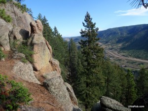 Soon after riding past the turn to the Pikes Peak Highway, it was time to head for higher elevations. After I turned onto Picabo Road, it just kept getting steeper and steeper. By the top I think it was the steepest paved road I’ve been on.
A left turn From Picabo Road on to Mountain Road brought me to the Mount Esther Trail. Mountain Road wasn’t much of a road and looked more like a dirt driveway. Except for a couple very short sections, Mt. Esther Trail was about a 30 minute hike-a-bike that climbed high above Chipita Park.
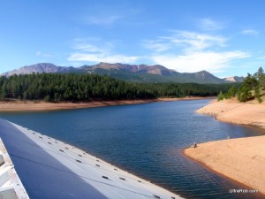 The reward for climbing up Mt. Esther was some great riding through the trees on a mix of singletrack and access roads. I passed Crystal Reservoir and South and North Catamount Reservoirs. A bit of the route used part of the Sand Creek Series Catamount course that I raced back in the mid-90s and hadn’t ridden up there since.
After riding through more beautiful areas, the route popped out onto the graded road just below the Crags Campground. I rode into the campground and used the pump there to get some water. I thought I had at least close to enough water left to get me to the Gillette Flats spring but didn’t want to run out. I only half filled my 100 oz bladder because I didn’t want to carry more weight than I needed to.
In between the Crags campground and the descent from Horsethief Park down to CO 67, there are couple climbs with a fun descent in between. By the 2nd of this climbs, I was definitely feeling the ride and wasn’t too happy to be climbing. It didn’t take long though to get over the top and do the fun descent through Horsethief Park and down to CO 67.
CO 67 is a gradual climb and has quite a bit of traffic with people going to Cripple Creek but isn’t too long. I started feeling a couple twinges of cramps soon after getting to the road. I stopped, took some Endurolytes and sat down for a short break the first time on the ride. After a few minutes, I continued on to the spring along CO 67 and filled up the full 100 ounces.
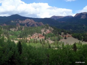 From there I had a few easy miles on Highway 81 and Gold Camp Road. I spun easy and tried saving some energy because I had an idea of what was coming up.
All too soon I was at the left turn to start up the Beaver Creek access road to the Pikes Peak South Slope reservoirs. I had never ridden it before but I was up it in a car last summer when I hiked on the Pikes Peak South Slope. I remembered it as being steep and the GPS track from Scott Morris’ ride report also showed it as a steep climb.
I stopped to get something from my pack and 2 guys that were bike packing rode by. They told me Ryan and BJ were just behind them. I was surprised to hear that and wondered where I had passed them.
It wasn’t long before I heard someone call my name and looked back to see Ryan with BJ not far behind him. It turned out they had stopped at the KOA on Highway 81 for a snack. Apparently I rode by while they were stopped.
Just after joining with Ryan and BJ, it started raining. It poured but fortunately only for about 5 minutes and the lightening wasn’t too close.
We rode up to the gate that blocks access to the Pikes Peak Slope reservoirs. From there the Ring the Peaks route heads up a steep, washed out jeep road. The bike packers were stopped there and we all took a short break.
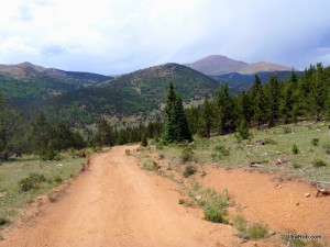 Then we started the hike-a-bike on up to the 11,300 high point. I was feeling low on energy and as we went up the other 4 slowly pulled ahead. Then I totally bonked and it was all I could do to keep moving forward. As I neared the top, it wasn’t as steep and I should have been able to ride but it was all I could do to just walk. Once over the top, it was a quick descent down to Elk Park.
Just after starting the short climb up from Deer Park to the Almagre Road, I meet a big Ram truck coming toward me on a narrow rocky section. He stopped so I could go by but the truck pretty much took up the whole road. I thought I could ride up on the bank a little to get by.
My rear wheel slid out when I was halfway past the truck. I had trouble un-clipping and pretty much fell over before I got out of my pedals. Just as I slid out, the guy decided to pull forward to try giving me more room. I watched in horror as my rear wheel slid in front of his back wheel and he rolled on to it.
He saw it happening and stopped. There I sat squatting on the bank of the road looking at a big, heavy truck with it’s back wheel covering my tire, rim and a couple inches of my spokes on the edge farthest from me. I had the guy back up so he wouldn’t drive over more of my wheel.
I was amazed to see that my rim wasn’t crushed but didn’t know how much it would be bent. I pulled the bike up and gave the wheel a spin. It had a pretty good wobble to it but not bad enough for the tire to hit the rim. The guy felt really bad and I think would have given me a ride but I told him I thought I’d be able to ride it.
I was a bit cautious as I started riding but everything felt Ok. It wasn’t long until I was up to the Almagre Road and ready to start descending nearly 5,000 feet to town below by way of the Jones Park downhill.
It didn’t take long until I was down to the 701 trailhead. A thunderstorm was moving in and lightening was closer than I liked. I had thought maybe the other 4 guys would wait at the trailhead but wasn’t surprised to see they were gone with the storm so close.
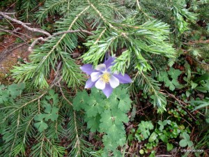 Although one way to get to Jones Park is to stay on the 701 trail, the Ring the Peak route quickly turns onto the 668 Trail for some steep descending. The 668 Trail then becomes the Pipeline Trail and is fairly flat most of the way over to Jones Park. Once at Jones Park, the trail turns downhill again on Captain Jacks and then on down the 666 Trail to High Drive.
After going a short distance down High Drive, the Ring the Peak Trail turns onto the Palmer Trail and then uses Section 16 and Intemann over to Manitou. The Ring the Peak 100(ish)k race can’t use this section and so we weren’t planning to ride it. I had nothing left in my legs for it anyway and was happy to continue down to Old Colorado City and then spin easily back into Manitou Springs.
It certainly was an epic day on the mountain bike and every bit as tough as I’d been hearing. I ended up with almost exactly 65 miles and 9 hours and 40 minutes of ride time on the GPS. It kept auto pausing on the hike-a-bike sections so I was probably moving a little more time than that. Total elapsed time was nearly 11.5 hours. Cumulative climbing came in at 10,885 feet.
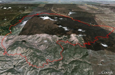
I’ve put the Ring the Peak map and elevation profile over here.
Related Links:
- More Ring the Peak Trail Photos
- Jones Park Downhill Loop
- Ryan Kohler’s Ring the Peak Recon Ride Report
|
|
|
Tags: Colorado Springs, Forester Trail, Jones Park, Manitou Springs, Pikes Peak, Ring the Peak



 Blog RSS Feed
 Like on Facebook
 Follow on Twitter
 Flickr
 Contact

Why aren’t they including the Palmer/Section 16 sections in the race?
Sounds like a pretty epic day. I’d love to do that route sometime.
The race site says “Section 16, Palmer Loop, and Intemann Trail are not included in this event due to city regulations.” Not sure what the regulations are.
[…] on many of the same trails. For me it’ll serve as my final long training ride before the Ring the Peak 100(ish)k […]
[…] October 6th is the Ring the Peaks Race. This race is a tough 70ish mile ride around Pikes Peak on Ring the Peak Trail. There’s no entry fee and no […]
[…] these trails for over 25 years. Here’s a Jones Park ride report from a couple years ago. The Ring the Peak mountain bike race also uses these […]
[…] stabilized and maintained so it doesn’t deteriorate further. Other outdoor projects include Ring the Peak (Pikes Peak), Implement the Bike Master Plan, Bike share program and Pikes Peak Greenway […]
[…] stabilized and maintained so it doesn’t deteriorate further. Other outdoor projects include Ring the Peak (Pikes Peak), Implement the Bike Master Plan, Bike share program and Pikes Peak Greenway […]
[…] stabilized and maintained so it doesn’t deteriorate further. Other outdoor projects include Ring the Peak (Pikes Peak), Implement the Bike Master Plan, Bike share program and Pikes Peak Greenway […]
[…] these trails for over 25 years. Here’s a Jones Park ride report from a couple years ago. The Ring the Peak mountain bike race also uses these […]