A New Threat?

June 25th, 2010

Two recent reports of attacks on hiking trails are disturbing, but one is even more frightening than the other. On June 17, a man was attacked and killed by a grizzly bear near the east entrance to Yellowstone National Park.  The area is known for its grizzly activity and park rangers say written warnings were posted and the man was warned verbally, but he didn’t carry any pepper spray or other bear defense gear.

On Sunday, a woman hiking on a trail in north Boulder was attacked, but this time, the attacker wasn’t a wild animal. It was a man – a short thin man who was carrying a knife.  This one ended better – the woman punched her attacker and escaped, and he was later arrested near the trailhead.

The Boulder attack and a similar one last September on Signal Mountain Trail near Fort Collins are reminders that animals aren’t the only dangers on the trail.  Literature about trail safety often talks about what to do if you meet a bear, or a mountain lion, but rarely mentions human encounters.  I know many women who hike alone.  Most of them don’t carry a weapon that could be used against animal or human. 

I carry a folding knife in my backpack, but I don’t know if I could or would ever use it to defend myself.  I’ve had a few unusual encounters in the outdoors – once at night, when a man dressed as a Ninja ran through our backcountry campsite and another time when deputies were called in after campers in a Forest Service campground started playing with their pistols at night, shooting into a raging bonfire they had built. 

The latest attack, in Boulder, got me thinking about trail safety again.  What do you think? Should we be more aware of potential human danger on our hiking trails and in our forests?  Or are these isolated events that could have just as easily happened on a city street?  Have you ever had such an encounter?  Have you thought about what you would do if your attacker wasn’t a black bear or a mountain lion but was a person?

– Deb Acord

Salomon X Alp Pro GTX Hiking Boots
Regular Price: $280.00
$209.95 on sale
 
Asolo TPS 520 GV Evo Hiking Boots
Price: $268.44
 
Salomon X Alp Mid LTR GTX Hiking Boots
Price: $219.95
 

First Public Hike of Pikes Peak South Slope

June 24th, 2010
Boehmer Reservoir with Pikes Peak in the background (CSU photo)

The first public tour of the South Slope of Pikes Peak is this Sunday, June 27th. There will be a 7 mile hike and it’s limited to 20 people. Hikers will meet at 7:45 at the Red Rocks Open Space parking lto and caravan up to McReynolds Reservoir. Reservations are required and it costs $10.

Contact the Trails and Open Space Coalition at 633-6884 for more information or to reserve a spot. I’ve signed up. I hope some readers will join me for the hike. If you can’t make this hike, more on planned throughout the summer but I haven’t seen any dates yet.

Read my post from May on the Pikes Peak South Slope plan for information on the plan to open the area to recreation.

Update: I now have dates for hikes the rest of the summer

  • Saturday, July 10th
  • Saturday, July 31st
  • Sunday, August 8th
  • Saturday, August 28th
  • Saturday, September 11th
  • Saturday, September 25th

Also take a look at the Pikes Peak South Slope hike flyer.

UltraRob

Related Links

Salomon X Alp Pro GTX Hiking Boots
Regular Price: $280.00
$209.95 on sale
 
Asolo TPS 520 GV Evo Hiking Boots
Price: $268.44
 
Salomon X Alp Mid LTR GTX Hiking Boots
Price: $219.95
 

New Trail in Pikes Peak Region

June 24th, 2010

Thomas Trail - Green Mountain Falls, Colorado

Add a new trail to the impressive network that begins in Green Mountain Falls. The Kirkpatrick Trail officially opens Sunday with a community hike.  The trail opened last year, and connects more than two miles of trails built by the late H.B. Wallace to more than five miles of trails in the town of Green Mountain Falls.  Dedication ceremonies will begin at 10 a.m. at the H.B. Wallace Reserve Trailhead, located at 10199 Mountain Road in Chipita Park.  Hikers are asked to park in the large lot on Ute Pass Avenue at the east entrance to Green Mountain Falls and hike up Mountain Road to the trailhead.  Parking along Mountain Road is not recommended. Following the ceremony, members of the Green Mountain Falls Trails Committee will conduct guided hikes on the trails system.

The trail is narrow and shaded, and even though it never strays far from houses, it offers a feeling of solitude.  Connect this trail with the Thomas Trail and the Catamount Trail, and you have an entire day of hiking through mixed pine forests.  Compared to those two, Kirkpatrick is relatively easy, with a small stream crossing and a little stepping up on boulders.  Our favorite way to reach the eastern trailhead for Thomas or Kirkpatrick: Park by the lake downtown, and check the trail map posted there.  Head up to the east; check out Kirkpatrick and then head back and pick up Thomas.  Save Catamount for another day – it’s known for its steep switchbacks as it takes hikers up to the shore of Catamount Reservoir.

– Deb Acord

Salomon X Alp Pro GTX Hiking Boots
Regular Price: $280.00
$209.95 on sale
 
Asolo TPS 520 GV Evo Hiking Boots
Price: $268.44
 
Salomon X Alp Mid LTR GTX Hiking Boots
Price: $219.95
 

Manitou Incline Public Access Meetings

June 21st, 2010

Manitou Incline No Trespassing Sign

After a few failed attempts at legalizing hiking the Manitou Incline over the years, the process has finally moved farther than it has in the past. Nearly $100,000 is being spent to study how to make the Incline safer, reduce erosion and to deal with traffic and parking issues on Ruxton Avenue. Colorado Springs Utilities is also concerned about the water pipeline that runs along the Manitou Incline.

Manitou InclineHiking the Manitou Incline has continued to grow more popular even though it’s illegal. The U.S. Forest Service has estimated that 70,000 people use the Incline annually.

At a Manitou Springs council meeting that I was at a little over ago, councilman Ed Klingman said making the Incline legal and having a plan would “move it from an unmanaged hassle to a managed hassle.” Spencer Wren, General Manager of the Pikes Peak Cog Railway, said the Incline was a huge problem for them. He said they were stopping hikers in their parking lot but they would just go up to the Barr Trail parking lot.

This Thursday evening there will be a meeting to get public input on the Manitou Incline. It will be held at Manitou Springs City Hall, 606 Manitou Avenue, from 7 to 9 PM. Manitou Springs also has a project page with more information and maps of the Manitou Incline.

One of the solutions I’ve heard is to have several places to park with trails connecting to the bottom of the Incline. When I asked Aimee Cox, the project manager about it she said, “We’re still in the information-gathering phase. Connecting trails has been suggested, but again, no recommendations are being made at this point. We’re trying to collect good ideas.”

The following additional public meetings will be hosted in July at Manitou Springs City Hall.

  • July 13th – Traffic and Parking Focus Area Session, 6 – 9 p.m.
  • July 14th – Trails and Trailhead Focus Area Session, 6 – 9 p.m.
  • July 15th – Management and Operations Focus Area Session, 6 – 9 p.m.

The planning process is funded by Great Outdoors Colorado and the Hill Family Foundation. The final plan will be presented to the Colorado Springs and Manitou Springs City Councils in February 2011.

For more information, please contact Aimee Cox at 719-385-6532 or aicox@springsgov.com.

THE INCLINE IS PRIVATE PROPERTY AND POSTED NO TRESPASSING. PUBLIC ACCESS ON THE INCLINE IS NOT ALLOWED. TRESPASSING ON THE INCLINE IS ILLEGAL.

UltraRob

Related Links

Salomon X Alp Pro GTX Hiking Boots
Regular Price: $280.00
$209.95 on sale
 
Asolo TPS 520 GV Evo Hiking Boots
Price: $268.44
 
Salomon X Alp Mid LTR GTX Hiking Boots
Price: $219.95
 

Pikes Peak South Slope Plan

May 6th, 2010
Pikes Peak from Proposed Boehmer/Mason Trail
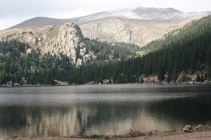
Pikes Peak from Proposed Boehmer/Mason Trail (CSU Photo)

Colorado Springs Utilities presented the latest Pikes Peak South Slope Plan a little over a week ago on Tuesday, April 27th. I was there along with over 60 others. There were some positive changes based on the feedback given on draft Pikes Peak South Slope Plan presented in January.

One of the changes is the decision to allow mountain bikes on proposed Boehmer/Mason Trail loop that was initially proposed to be closed to bikes. The downside is they’re proposing to increase the trail width to 4 feet to minimize conflict between mountain bikes and other trail users. 4 feet is wider than true singletrack and I doubt it’s necessary. Also trails tend to widen over time so I don’t think they need should start so wide.

Based on the feedback from the January meeting they are now proposing a trail connecting from the Lake Moraine Trail over to the Boehmer/Mason Trail area. This could be a key segment to make completion of Ring the Peak Trail a reality. It also would allow for some epic mountain bike rides connecting with the Barr Trail area. Since it wasn’t on the original plan and it’s been too snowy for them to take a good look at the area, there’s no specific trail location specified.

Although there are no specific plans for building any trail for completing Ring the Peak Trail, they didn’t seem so opposed to it. Most of the sensitive big horn sheep habitat where it makes most sense for the trail is on Forest Service land. There would also need to be a connection through Colorado Springs Utilities land. CSU said they would work with the Forest Service to see if it would be possible.

Another new proposal that I don’t like is allowing limited hunting. According to their slide on the feedback received, they got over 120 comments supporting hunting. That’s over double the number supporting the Ring the Peak Trail which had the 2nd most comments. Although a couple people brought it up at the January meeting, there didn’t seem to be much support for it. My guess is some group organized and sent in a lot of comments online. I’ve heard bullets whiz by me more than once while mountain biking so I’m not excited about hunters being in the area.

I hadn’t noticed before that dogs won’t be allowed on the Pikes Peak South Slope. Because of wildlife concerns especially with the big horn sheep, it makes sense to not allow dogs.

There weren’t a lot of comments but the most were about the trail being so wide and the area being closed in the winter. The plan is for the area to only be open from mid-May through mid-October. People, myself including, would like to be able to snowshoe and cross-country ski on the trails even if it means starting at Gold Camp Road.

So the big question that hasn’t been answered yet is how the building of the trailheads and trails and the ongoing maintenance will be funded. Colorado Springs Utilities will pay for the detailed plan to be completed. The Colorado Springs Park and Recreation department will be responsible for finding the funding for building and maintaining the trailheads and trails. The parks department has had their general fund budget slashed from close to $20 million in 2008 to about $3 million this year so that’ll be a challenge.

The number being used at the meeting was somewhere around $2 to $2.5 million for building everything in the plan. Other places I’ve seen estimates as high as $4 million. Tom, the presenter, said the about $2 million amount is based on bringing in a commercial contractor to do most of the work. Using volunteers to build trails would bring that down. However, the single biggest cost is building bridges and boardwalks over sensitive wetlands and that may be hard to reduce much with volunteers. He said that’s about $900k and I found nearly that much with a quick glance through the costs section of the plan.

At least some funding could come from the Trails and Open Space (TOPS) program. Also the project seems like a great fit for money from Great Outdoors Colorado (GOCO) which is funded from the state lottery proceeds. Fishing is Fun Grants (CDOW), the Fish and Wildlife Resources Fund, Trail Construction Grants (Colorado State Trails Program) and Conservation Trust Fund are listed as other funding sources for construction. Most likely a fee based system will be used to provide ongoing funding.

Another part of the plan that isn’t on the Pikes Peak South Slope is the improvement of the Ute Trail. The Ute Trail runs from near the base of the Manitou Incline to Cascade. Although it isn’t currently an official trail, it is well used but has some very steep sections with erosion issues. The proposal is that El Paso Country Parks will be in charge of the improvements and manage the trail.

You can find many more details including maps, photos and charts in the 88 page plan posted online. You can find some additional information on main Watershed Access Project page including an online form to submit comments by May 18th. It also gives information on getting notified of volunteer or guided tour opportunities.

– UltraRob

Related Links:

Salomon X Alp Pro GTX Hiking Boots
Regular Price: $280.00
$209.95 on sale
 
Asolo TPS 520 GV Evo Hiking Boots
Price: $268.44
 
Salomon X Alp Mid LTR GTX Hiking Boots
Price: $219.95
 

i-gotU gt-120 GPS Logger Review

February 24th, 2010

Since this summer I’ve been using a little GPS logger to record some of my mountain bike rides and hikes. It’s the i-gotU gt-120 GPS Logger from Mobile Action. As you can see in the photo above it’s very small.

Unlike the Garmin Edge 705 that I have for navigating and seeing my speed, distance, etc. while I’m riding, the GPS logger just records for download after the ride. Since I have the Edge 705 you may wonder why I’d use both. I received the i-gotU from Mobile Action so I could review it and ended up finding it very useful.

Since it’s water resistant, I’ve been just throwing it in my jersey pocket or hydration pack along with whatever else I’m carrying. It has a blue rubber bumper that fits around it to help cushion impacts. I haven’t taken any hard falls with it but it’s held up well bouncing around in my pocket.

It’s designed as a travel logger so you can share your adventures. The software that comes with the GPS logger makes it easy to geotag photos you take. If you aren’t familiar with geotagging, it adds GPS coordinates to photo files so services like Flickr can place them on a map.

It’s best to have the time set correctly on the camera since the software places the photos based on time. Even if the time isn’t set correctly, the software that comes with the gt-120 provides an easy way to adjust the time. If you know the time difference, you can enter it or you can drag the slider until it shows the photo in the right spot on the map.

Once photos have been added, you can then easily upload the map and photos to the web. They provide some space free on their @trip site and then you can buy additional space. Photos can be uploaded to @trip, Flickr or Picasa.

Once you’ve uploaded the map, you can share the link with friends or embed the map on your blog as you see below. You can also save the trip to file as a web page in .mhtml format or the Google Earth files as .kml or .kmz. When the map is uploaded to their website, they significantly reduce the number of waypoints so you don’t get as accurate of a route as you get saving it to file.

For me, saving to a Google Earth file is very useful. I used to need a couple software programs to create a map with photos of my rides. Now with the GPS logger and software it’s easy. I do have to do a bit of editing so the paths are right when I put it online. I made this Pueblo Reservoir map using the gt-120 and software.

The gt-120 has plenty of storage with 64,000 waypoints. It can be configured to store a waypoint every second or every several minutes and anything in between. There’s a setting to have it log at a different interval if your speed is higher than a set amount. I’ve been using mine with it set to log every 6 seconds. If my math is correct, that would mean I can store over 100 hours of data before it fills up.

How often a waypoint is saved also affects how long the battery lasts. With it set to log it estimates the battery will last 10 hours. I’ve used it a little longer than that without a recharge without a problem. Setting the logging interval to 12 seconds, gives an estimate of 30 hours of battery life.

The i-gotU GPS logger also is designed to work as a GPS receiver for navigation software. I haven’t tried using it that way so don’t know how it works.

i-gotU gt-120 GPS Logger Likes

  • Small Size
  • Easy to geotag photos
  • Easy to share adventures
  • Reasonably accurate even when in jersey pocket or outer pocket of pack

i-gotU gt-120 GPS Logger Dislikes

  • Charging and downloading data require a special USB cable. It’s probably used to keep dirt and water from getting in port.

  • Blue and red lights that indicate whether the logger is on, locked on satellites, etc. are very hard to see in sunlight.
  • The only charger is the USB cable so you need a computer or an adapter to charge it.
  • Some parts of the software aren’t intuitive

i-gotU gt-120 GPS Logger Specs

  • Dimension: 1.75 x 1.1 x 0.5 inches
  • Weight: 0.7 oz
  • Built-in SiRF StarIII 65nm low-power chipset
  • Built-in GPS patch antenna
  • Built-in flash memory
  • Built-in 230mAh Lithium-ion battery
  • 2 LED for tracking and battery/charger status indication
  • USB 1.1 interface for PC connection
  • Operation temperature: 15 to + 120 degrees Fahrenheit

UltraRob

Salomon X Alp Pro GTX Hiking Boots
Regular Price: $280.00
$209.95 on sale
 
Asolo TPS 520 GV Evo Hiking Boots
Price: $268.44
 
Salomon X Alp Mid LTR GTX Hiking Boots
Price: $219.95
 

Pikes Peak South Slope Meeting January 2010

January 29th, 2010
Boehmer Reservoir with Pikes Peak in the background (CSU photo)

Update: At the meeting the end of April, they presented a mostly final Pikes Peak South Slope plan that included several things that were brought up in this meeting.

The Pikes Peak South Slope recreation meeting on Tuesday was very well attended. I counted somewhere close to 130 people.

There weren’t any major surprises from what I wrote before the meeting based on what I had heard. After writing that I also obtained a copy of the concept plan.

The written plan doesn’t have any information in it about who’s going to pay to build the trails and parking lots or how it’s going to be maintained. It turns out that’s because they really don’t have a plan. It did seem pretty clear that it’ll include user fees and could include a private company managing it.

Tom, the presenter, said they want to phase in access and trails because they don’t want to rush and damage a sensitive area. Barry from the Gazette said that we’re already 11 years into the process and he didn’t feel there was any danger of rushing into it. He also brought up that the Denver Water Board also manages recreational access to similar areas.

The reason given for not having a plan that would include a section of the Ring the Peaks Trail was that the Forest Service doesn’t want a new trail. CSU doesn’t want to build a trail that would deadend at the Forest Service boundary. Although I think the Forest Service is reluctant to build the trail, it seems they’re both pointed at the other and using it as an excuse rather than working together.

Their main reason for restricting mountain bikers is the bighorn sheep. There’s believe to about 200 sheep in the area. Utilities was told by a biologist that the speed of bikes scares the sheep. They didn’t know if there were studies showing that. Jim from Medicine Wheel pointed out a study in Canyonlands referenced on the IMBA site that showed that hikers caused significantly more severe responses from desert bighorn sheep than mountain bikers.

I don’t know how the response is similar between desert sheep and our high country bighorn sheep. Still it seems that they are using the sheep as a way to keep mountain bikes out and possibly don’t have sufficient scientific data to back it up. Maybe the area should just be closed to all users during the lambing season.

The main recreation groups of hikers, mountain bikers, equestrians and fishers were well represented. There were also a few rock climbers, hunters. When they asked for who was there for the various types of recreation, it looked like over half the room raised their hands for both mountain biking and hiking. That’s not surprising since there’s a lot of people that do both. Equestrians represented about 20% with a smaller number of fishermen.

Most of the equestrians were happy with the initial plan. I didn’t get a good feel for how hikers felt other than being disappointed about the Ring the Peaks Trail. Mountain bikers definitely weren’t happy about not getting access to the South Slope reservoir area.

If you didn’t make the meeting but want to make comments, fill out the comment form due by February 26th. There’s information on the Watershed Access Project page for emailing it to CSU. They plan to have another public meeting in April with plan refinements based on the feedback they receive. They plan to finish up the planning phase by June.

UltraRob

Salomon X Alp Pro GTX Hiking Boots
Regular Price: $280.00
$209.95 on sale
 
Asolo TPS 520 GV Evo Hiking Boots
Price: $268.44
 
Salomon X Alp Mid LTR GTX Hiking Boots
Price: $219.95
 

Bears in the Woods? There’s an App for That

January 19th, 2010

One of the tips for staying safe while hiking in bear country is to wear bells. Unless they’re startled, protecting young or guarding food, most bears prefer to avoid humans. The bells give the bears time to move out of the way without feeling threatened. Fortunately every time I’ve seen a bear on the trail they’ve been in a hurry to get away from me.

Now there’s a high tech way to alert bears. The ScareBear Trail Companion iPhone app gives the option of bear bells, rocks in a tin can or hands clapping to alert bears that you’re coming. If you do encounter a bear, mountain lion or other wildlife you can tap to use an air horn sound to scare them. The app costs 99 cents.

I was curious about the app so I paid my 99 cents and downloaded it. I don’t know if the app really requires it but it won’t install without the 3.1.2 software update. I hadn’t updated from 3.1 so I had to do the update first.

The volume of the sound is determined by the iPhone’s volume control. With the volume all the way up, it is loud enough to be bothersome for bear bells, rocks in a tin can or hand clapping. The air horn doesn’t really sound much louder than the other sounds. My dog lying in my office didn’t even bother opening his eyes. My kids can certainly scream a lot louder.

The ScareBear Trail Companion iPhone app comes with a very long disclaimer list. It includes agreeing that the app is sold as a novelty item.

I have concerns about carrying my iPhone out where it could be heard in wet or dusty conditions. Although I didn’t test how long the battery lasts with it playing, the sound does keep playing when the screen is off so I would guess it is too big of a battery strain.

My recommendation is to stick to the low tech bear bell fastened to your pack or shoes. It’ll be more reliable and easier on the ears. I guess if you do forget your bear bell, you could use the app as a backup.

UltraRob

Salomon X Alp Pro GTX Hiking Boots
Regular Price: $280.00
$209.95 on sale
 
Asolo TPS 520 GV Evo Hiking Boots
Price: $268.44
 
Salomon X Alp Mid LTR GTX Hiking Boots
Price: $219.95
 

Doggie Gifts

December 15th, 2009
Dog Hiking in Snow with Packs

It’s time to think about holiday gifts for your significant other – your dog.

Here’s some of my favorite outdoor gear for dogs

Cool Pooch Sport Bottle. We used to try and give our dog drinks from our Nalgene bottles, but most of the water ended up on the ground. So several years ago, we tried the Cool Pooch bottle, and now we never hike without it. Its innovative design with a plastic straw allows you to drink from the bottle and pour water into the attached water bowl for your dog to drink.

Doggles goggles. You wouldn’t think about heading out in the snow without your sunglasses. All that glare can harm your dog’s eyes, too. Doggles have fully adjustable head and chin straps and their lenses are cushioned with foam.

Lands End Dog Squall Jacket. We aren’t really into dressing up our beagle, but when the temperature drops, he starts to shiver. This practical jacket is wind- and snow-resistant, fleece-lined and easy to put on, and it’s trimmed with reflective binding.

Dog booties from Dogbooties.com  We tried to get our Lab to wear these a few years ago, and he high-stepped it around the house until he got them off his feet. But I know these things work – I’ve seen them on hard-working sled dogs in Alaska and Colorado. They come in nine colors.

REI Adventure Dog Tent. We’ve never had a tent for our dogs, but I love the idea of it. This would be perfect for a multi-day car camping trip. It weighs two pounds, five ounces, and is 45 by 37 by 31 inches.

Deb Acord

Related Links:

Salomon X Alp Pro GTX Hiking Boots
Regular Price: $280.00
$209.95 on sale
 
Asolo TPS 520 GV Evo Hiking Boots
Price: $268.44
 
Salomon X Alp Mid LTR GTX Hiking Boots
Price: $219.95
 

Barr Trail Makes “Dangerous” List

November 9th, 2009

photo courtesy PikesPeakCam.com

In its most recent issue, Backpacker magazine lists “The Ten Most Dangerous Hikes in America.” Some of the entries aren’t surprising: the brutally hot Bright Angel in the Grand Canyon, the well-named Maze in Utah.

The list also includes Barr Trail. For those who are constantly frustrated by the bad rap Barr often gets – “it’s a sidewalk;” “it’s among the easiest 14er hikes” – the idea that Barr is really a badass might be good news.

But lightning is the dangerous reason Barr made the list, and it’s always been a component in any hike on Pikes Peak.

My scariest hike on Barr occurred a few years ago during an early September thunder/snowstorm. I was leading a group of friends, all first-timers to the trail, from the summit back down to Barr Camp where we had booked the guest cabin for the night.

Storms weren’t forecast, and skies were uniformly gray when we left the summit, but about two miles down, it started snowing and thundering. When one of my friends asked innocently, “why are the (metal) trail signs humming?” I knew we were in trouble. We spread out and kept moving downhill and made it to the cabin unscathed. (That hike is forever known by my clever friends as “the day Deb tried to kill us.”)

Turns out we did a couple of things right – we started in the morning, when there is (usually) a lower risk of storms, and we spread out when the storm started. But when you’re above tree line on Pikes Peak in a lightning storm, it’s nearly impossible to make yourself follow the other conventional lightning safety tips: take off your pack and move away from it; crouch down and balance on the balls of your feet.

Instead, the impulse is to flee, which takes a while on Barr (unless you’re Matt Carpenter).

Deb Acord

Salomon X Alp Pro GTX Hiking Boots
Regular Price: $280.00
$209.95 on sale
 
Asolo TPS 520 GV Evo Hiking Boots
Price: $268.44
 
Salomon X Alp Mid LTR GTX Hiking Boots
Price: $219.95


Email: web@ultrarob.com

Business Seal       Privacy Seal