A few weeks ago the Forest Service had an open house about proposed trail closures due to the greenback cutthroat trout in Bear Creek. I’m not convinced they’ve studied the impacts of the trail well enough to say they’re a problem but because of settling a lawsuit with environmental groups it probably doesn’t matter what the impact is. The US Fish and Wildlife Service must approve any trail work in the Bear Creek drainage including current trail maintenance.
At the open house, 3 alternatives were shown. Alternative A is the current trail system and we know that there’s very little chance the trails will remain the same in the future. Alternatives B and C have various trail closures and re-routes.
Both new alternatives would still allow the “Missing Link” trail to be created to link Barr Trail to the Jones Park area but would make it longer because of going around Jones Park and I believe add an uphill section. Also with both proposals, High Drive would be closed to vehicle traffic but would be open to non-motorized use.
Alternative B has all of Jones Park off limits and the upper part of Bear Creek Trail (666) closed. A trail re-route from Pipeline would keep Captain Jacks away from Bear Creek and connect where Captain Jacks currently drops down from the ridge to the creek and intersects with 666. A connector would be created from Buckhorn over to 666 near Josephine Falls.
I believe Alternative C is the same as Alternative B except that all of Bear Creek Trail (666) would be closed. I don’t think you’ll find it surprising that I don’t like this plan.
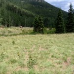
One part of “Alternative B” that I’m not sure is necessary is the complete closure of Jones Park at least to non-motorized use as that area is flatter and doesn’t have nearly the erosion issues of lower on Cap’n Jacks. Most of Jones Park is Colorado Springs Utilities land and I don’t think they want to make sure they have no risk with the greenback cutthroat trout.
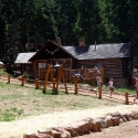
One effect of closing Jones Park is access to Mt. Arthur and Mt. Garfield will be more difficult. It would be nice if a trail could be built from the Section 16 area to allow more access into that area. Also there are ruins of historic buildings in the Jones Park area that would be off limits.
It’s not clear how long it will be before the whatever plan is approved will be implemented. The US Fish and Wildlife Service have until late summer to approve the plan the Forest Service submits to them.
I talked to Forest Ranger Allan Hahn at the meeting last month about how soon trail re-routes could be done after a plan was approved. Although the Forest Service doesn’t have money for the changes, he believes the plan could be implemented in a matter of weeks since so many people are willing to volunteer to get access to the area. I’m not optimistic that with all the government red tape that volunteers would be turned loose to get the re-routes done that quickly.
Now it’s time to move forward and get the best possible trails under the circumstances. Input on the proposals can be sent to the Forest Service by emailing bcc@fs.fed.us, faxing (719) 477-4233 or mailing. Comments must be received by March 27th, 2014. One thing a found from talking to the Forest Service is they don’t understand very well how people use the trails and that it would be helpful to them to know more.
The Gazette did an article that includes some of history of the Bear Creek area. Someone who is fighting against any closures also has history on the area with historic photos. At this point, I don’t believe fighting the changes is productive but the page has some interesting information.
Below is the letter the the Peak Mtb Collective has been asking people to sign at the informational meetings they’ve held. Use it as is or as a starting point for your feedback to the Forest Service. Also go to the Peak Mtb Collective page and sign up for email updates on the Bear Creek drainage trails and other Colorado Springs area trail issues.
|
|
|
Bear Creek Watershed Restoration Project
Pikes Peak Ranger District
601 S. Weber Street
Colorado Springs, CO 80903
719-477-4233
bcc@fs.fed.usIn reviewing the proposed changes to travel management and recreational activities and the improvement actions for the stream habitat in the Bear Creek Watershed Restoration Project (BCWRP) area, I understand that the project’s purpose is to protect the greenback cutthroat trout as well as to maintain a balance among the many trail user groups. The area in question has a well-established, recognized trail system that is important to the outdoor lifestyle for which the Pikes Peak region is known.
As an avid user of the Bear Creek area and Pikes Peak region trail systems, I am aware of the important balance we share with our eco-system. I have read full through the proposed BCWRP proposals and I support “Alternative B” as the action plan for implementation by the Pikes Peak Ranger District. I believe “Alternative B” supports the objective of protecting the greenback cutthroat trout as well as offering a balance between access and use of this vast trail system.
Acknowledging that change is needed in the area, “Alternative A” offers little compromise regarding the ecological concerns of the project. “Alternative C” offers limited compromise by significantly limiting trail access including the complete closure of trail 666. I believe either of these plans hinders involved groups’ respective goals and could have negative long term effects.
I want to thank everyone involved in the project and look forward to seeing “Alternative B” move forward. I also extend myself as a resource in the implementation of “Alternative B” in the Bear Creek Watershed Restoration Project.






 Blog RSS Feed
 Like on Facebook
 Follow on Twitter
 Flickr
 Contact
