The next public meeting on legalizing hiking the Manitou Incline is tomorrow evening (Thursday, October 21st) at 7 PM at Manitou’s City Hall. The draft Manitou Incline plan will be presented and people will be able to give their feedback. The plan is based on input from the Incline meeting in June plus 3 focused workshops held in July.
The Forest Service had estimated that about 70,000 trips were made up the Incline a year. To get a better count, the task force put an automated counter on the No Trespassing sign. In September it counted 23,562 hikers. I don’t know if it was sophisticated enough to count just those going up or if it also counted people when they came down.
I know the couple times I was on the Incline in September there were probably only about half the hikers that I saw in June and July. The winter months see much lower usage so it’s possible that’s close to the average over the year. That would mean there could be 300,000 or more trips up the Incline a year.
The plan lays out 3 different stages, A, B and C. Stage A proposals are low cost for the most part and ares limited to management requirements for legally opening the Manitou Incline and critical improvements.
Proposed Changes in Stage A
The Incline crosses Colorado Springs Utilities, Pikes Peak Cog Railway and Forest Service land and about the bottom half is within Manitou Springs city limits. In order to simplify management, a single management entity is recommended. Only Colorado Springs and Manitou have expressed interest. The proposal is for Colorado Springs to be the management entity in partnership with Manitou. A special use permit will be needed for Colorado Springs to manage the trail within the National Forest.
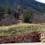 To make the Barr Trail parking lot more available to people hiking Barr Trail, the access to the Manitou Incline from the Barr Parking lot will be closed. The official trailhead will be at the true bottom of the Incline in the Pikes Peak Cog Railway parking lot. The Cog will lose 10-15 parking spots but be given designated spots on Ruxton in exchange.
The Barr Trail parking lot will become a paid parking lot. A gate activated by a credit card will collect the fee. The shorter the stay in the parking lot, the more it will cost to encourage it to left for those doing longer hikes on Barr Trail.
Parking is already an issue for those hiking the Incline and the proposed plan will make it even worse. Because residents haven’t been able to park near their houses, 59 parking spaces will be reserved for residents. In the narrowest section of Ruxton where I thought it wasn’t safe to walk up, 8 parking spaces will be removed to make it safer for pedestrians. These changes along with discouraging parking in the Barr Trail parking lot will remove about 100 of the 200 parking spaces that have been available. To offset some of it in the morning, the Cog will make 40 spaces available until 9 AM.
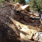 For safety and to reduce environmental degradation, the center part of the Incline will be stabilized and drainage controls put in place. The worst sections will be worked on first. Later phases will address sections that aren’t as eroded.
The social trail that connects the top of the Incline to Barr Trail will be rerouted to reduce erosion since parts of it currently are considerably too steep. They are also proposing a new trail to the north from the summit down to the Ute Indian Trail to reduce the use of Barr Trail. It seems the Forest Service is pushing for the new trail but it seems pretty ambitious for Phase A.
Minimal signage will be placed that will have a map and rules of use. Most of the rules are common sense things like use at your own risk, stay on the trail and carry out your trash. I have issues with 2 of the rules though. They are dawn to dusk use only and no pets.
 I think the dawn to dusk rule comes from complaints from residents about car doors slamming too early in the morning. I can understand that since I’m not a morning person. In the summer dawn to dusk may not be too bad but during the winter it would prevent hiking it after work even though it’s not that late. I think they should have a rule against parking in residential areas outside of certain hours but not have designated hours for the Incline. At a minimum they should allow hiking until 9 PM whether or not it’s light.
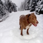 Dogs on trails seems to really get some people worked up even though in general Colorado is very dog friendly. I always hike the Incline with my dog because he loves it and needs the exercise. In the past I let him run free and the other dogs on the Incline were friendly and I didn’t have any issues. This summer when it became so crowded there were aggressive dogs on leashes that would lunge and snap at my dog when he walked up to them so I ended up keeping him leashed.
I think dogs should be allowed but they could require them to be leashed and prohibit the dangerous 15 foot or longer leashes. Owners should also pick up after their dogs.
For the most part the draft plan is reasonable and balances the needs of the Manitou Incline hikers with those of the residents and the Cog Railway. There are a few things I don’t like and don’t think are needed. I plan to be there to give my input and I suggest you also attend.
You can find the draft plan and other Incline information on Manitou Springs website.
For more information, please contact Aimee Cox at 719-385-6532 or aicox@springsgov.com.
THE INCLINE IS PRIVATE PROPERTY AND POSTED NO TRESPASSING. PUBLIC ACCESS ON THE INCLINE IS NOT ALLOWED. TRESPASSING ON THE INCLINE IS ILLEGAL.
Related Links
- Snowy Manitou Incline Photos
- Frosty Night on the Manitou Incline
- Sports Illustrated Mentions the Manitou Incline
|
|
|





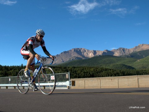
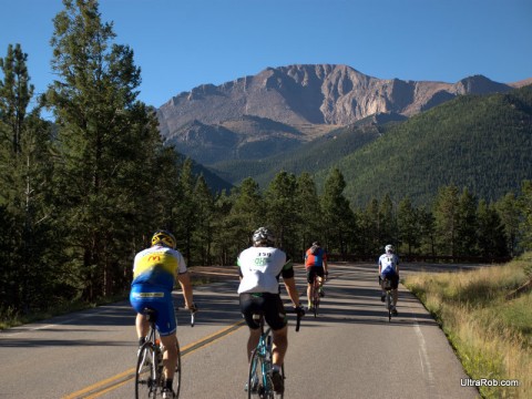





 So when the idea to create the ROLL Bike Art Festival in Colorado Springs presented itself, Seltzer (left) pursued it with confidence. She never considered that it couldn’t be done.
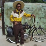
 A trip to the Chicago Critical Mass Bike Art Show gave her the idea to do a show in Colorado Springs. The ROLL Bike Art show started at the Smokebrush Gallery, then moved to the Warehouse restaurant. This year mark’s the show’s debut at Venue 515.
 “We’re all kind of coordinating and networking as we move forward,” Seltzer said. But the show has struck a deep chord with the people of Colorado Springs. Seltzer said the artwork, which ranges from pottery and sculpture to oil and watercolor paintings to some that is difficult to describe, helps residents express how they feel about cycling.
 Blog RSS Feed
 Like on Facebook
 Follow on Twitter
 Flickr
 Contact
