|
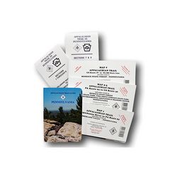
This set covers 229 miles, from Delaware Water Gap National Recreation Area to the town of Pen Mar on the Maryland border. A must for through hikers, it includes a guidebook, plus topographical and profile maps that are tear and water resistant. 216 page softcover book 10th edition 1998 size: 4 12 x 6 12 inches. Five multicolor topographic maps, with elevation profiles.. Sections 1 6: Delaware Water Gap to Swatara Gap scale: 1:63,360. Sections 7 8: Susquehanna River to Swatara Gap scale: 1:63,360. Map 1: Susquehanna River to PA Route 94 scale: 1:63,360 checked and reprinted in 2001. Maps 2 3: PA Route 94 to US Route 30 scale: 1:16,000 revised October 2000. Map 4: US Route 30 to PA MD State Line scale: 1:55,780 revised October 2000.
|


 Blog Feed
 Follow on Twitter
 Become a Facebook Fan
 Flickr
 MySpace


