|
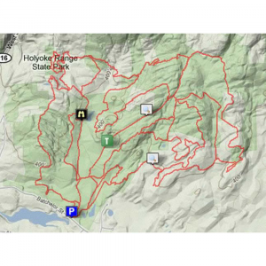
Holyoke Range West Trail MapEasily navigate your way through the Holyoke RangeSkinner State Park Western Section with this handy, easy to read trail map from New England Cartographics. Five color map with trail descriptions and related information on back. Printed on recycled paper with 10% post consumer waste using soy based inks. Fourth edition, 1994. 19 x 13.78 in. unfolded
|
| Merchant | Price | Regular Price | |
|---|---|---|---|
| Eastern Mountain Sports | $3.95 | $3.95 |
Copy the following string into an e-mail to support@ultrarob.com to request support.
Mozilla/5.0 AppleWebKit/537.36 (KHTML, like Gecko; compatible; ClaudeBot/1.0; +claudebot@anthropic.com)
Email: web@ultrarob.com
Similar Gear
| ||
| ||
| ||
| ||
|


 Blog Feed
 Follow on Twitter
 Become a Facebook Fan
 Flickr
 MySpace


