|
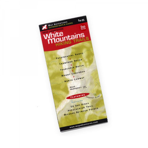
White Mountains Hiking Trails MapThis richly illustrated color map covers the highest and most popular peaks in the White Mountains of New Hampshire. Features:. . . 50 day hikes with full descriptions. The Appalachian Trail. Difficulty ratings. Mileage between points on hiking trails. AMC and White Mountain National Forest Huts and campsites. UTMGIS Grid. Updated trails and suggested hike info. Covers Crawford Notch, Presidential Range, Franconia Notch, Mount Chocorua, North Conway. Measures 9 x 4 inches. Weighs 1.2 ounces.
|
| Merchant | Price | Regular Price | |
|---|---|---|---|
| Eastern Mountain Sports | $4.95 | $4.95 |
Copy the following string into an e-mail to support@ultrarob.com to request support.
Mozilla/5.0 AppleWebKit/537.36 (KHTML, like Gecko; compatible; ClaudeBot/1.0; +claudebot@anthropic.com)
Email: web@ultrarob.com
Similar Gear
| ||
| ||
| ||
| ||
|


 Blog Feed
 Follow on Twitter
 Become a Facebook Fan
 Flickr
 MySpace