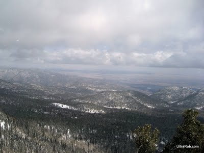
Since 1999 there have been several meetings to discuss public access and recreation on the South Slope of Pikes Peak. Colorado Springs Utilities has seven reservoirs fed by Pikes Peak snowmelt and rainwater on the South Slope. The area has been closed to the public since 1913.
Deb Acord has had the good fortune of seeing it for herself. She visited it several times with CSU escorts in 2002 when she was reporting on this plan for the Colorado Springs Gazette. She says, “Ever since then, I’ve been hoping for the day when I could explore this tangle of deep forests on my own.”
Colorado Springs Utilities has been soliciting input from stakeholders and members of the public for months. Now CSU is ready to present its latest proposed conceptual plan for recreation in the area. Tomorrow evening, Tuesday January 26th, there will be a meeting from 5:30 to 7:00 PM to discuss the latest plan. It will be held in the Pikes Peak Room of the Leon Young Service Center, 1521 Hancock Expressway.
It sounds like mountain bikers may be being kept out of the best part of the south slope. Someone that has seen an initial draft of the proposal says that there are new trails in 2 areas.
One of them is in the area I most think of as the South Slope. There will be access from Gold Camp road to several of the lakes and include a loop trail. Unfortunately this area will be open to hikers and equestrians but not mountain bikers.
This area is key in completion of the 63 mile Ring the Peak Trail. If you follow the link, you’ll see a missing section of the trail and it’s my understanding that this is the area where mountain bikes wouldn’t be permitted. I believe that’s a huge mistake. I don’t have enough details to know if the proposed trail will provide the necessary Ring the Peaks Trail connection for hikers either.
The 2nd proposed trail will provide a connection from Jones Park to the Barr Trail area around the Mount View Trail. Although this isn’t needed for the Ring the Peak Trail as it’s currently defined, it would allow for some interesting loops. Currently there’s really no way to connect by trail between the Cheyenne Cañon/Bear Creek Canyon area and areas near Barr Trail other than dropping to the Intemann Trail.
If you live in the Pikes Peak region and care about our trails, I’d suggest you go to the meeting tomorrow and give your feedback. If you’re a local mountain biker, you really need to be at the meeting and let your voice be heard if it’s true that they’re proposing no mountain bikes in the South Slope reservoir area.
Update: I’ve uploaded a copy of the Pikes Peak South Slope Access Plan. The reasons it gives for restricting mountain bikes is “to allow for a wilderness like experience and to reduce the risk of fast moving recreation impacting bighorn sheep.” With my initial quick look, I also don’t see that the plan will allow completion of the Ring the Peaks Trail.
– UltraRob
Related Links
- Pikes Peak South Slope Redux
- CSU Changes Tune on South Slope Access
- Colorado Springs Watershed Access Meetings
|
|
|
Tags: Colorado Springs, hiking, mountain biking, Pikes Peak


 Blog RSS Feed
 Like on Facebook
 Follow on Twitter
 Flickr
 Contact

Leave a Reply